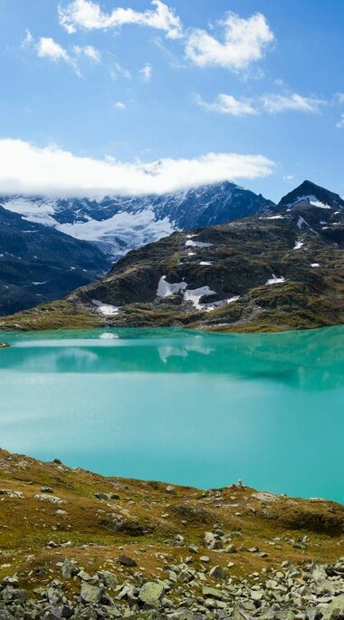
Uttendorf/Weißsee offers a variety of hiking and climbing opportunities for all levels. There are also daily guided hikes (weekly programme).
In the Weißsee Glacier World, a vast panorama opens up, surrounded by numerous three thousand metre peaks. Due to its high alpine location, the Weißsee Glacier World is an eldorado for true alpinists. It is the starting point for climbing numerous three thousand metre peaks. There are also plenty of opportunities for beginners and children.
For an overview of our network of hiking trails, see our digital hiking map.
EXPERIENCE HIKING TRAILS
Butterfly trail
A walk for the whole family!
Follow the Dorfbach road to Stefflbauer, where you will find the first information board. Then you cross the exposed dry slope with its thermophilic plants and insects, where you can often admire the life of colourful butterflies such as the swallowtail, Apollo, lemon, peacock, little fox, admiral, mourning cloak, Schiller and many more.
There are places to sit and rest along the easy walk through the Steinertal valley. Before you reach the Liebenberg mountain inn, a popular destination for day-trippers, the path runs along the edge of a forest, past meadows and through an old orchard. Enjoy the beautiful scenery and be amazed by the many "flying gems"!
The trail starts in the centre of the village and ends at the Liebenberg alpine guesthouse after about 1.5 hours of walking. The difference in altitude is 300 metres.
A special incentive for children is our quiz questionnaire. There are several boards along the Butterfly Trail with questions to answer (available at the Tourist Office)!
HEALTHY UPHILL WAY
Healthy Uphill way - this is the motto under which mountain hikers in the National Park community of Uttendorf/Weißsee can get in the mood for the varied tours in the high mountains.
There are about 300 metres of altitude to hike, but not at a rapid pace, rather at a leisurely one, interspersed with a few breaks reserved for leisurely exercises: breathing, stretching, hanging,.....
The aim of this path is to "harmonise body, mind and soul and to recharge your batteries". Not through strength training, but through relaxation.
The beautiful nature trail leads through forests and meadows with stunning views of the Hohe Tauern mountains. Various boards remind you of the creative breaks and formulate the movements, which are easy to perform.
GLACIER TRAIL TO THE "SONNBLICK-KEES"
The Glacier Trail offers a beautiful high mountain panorama with 22 peaks, 12 of which are over 3,000m, and leads directly to the foot of the impressive "Sonnblick-Kees". You feel at one with nature and can only marvel at the vibrancy and sheer size of the glacier and its constant changes.
- Starting point: Weißsee Glacier World mountain station/Rudolfshütte (2,315 m)
- Walking time: approx. 2 hours, for the round trip 2.5 hours
- Height difference: approx. 250 m
GLACIER TRAIL TO THE ÖDENWINKEL-KEES
The trail takes you through magnificent high mountain scenery over the "Schafbühel" to the "Eisbodenlacke", and from here through terrain that has been ice-free since the middle of the last century to the glacier front of the "Ödenwinkelkees".
Along the way and in the surrounding area you can also see a variety of alpine animals (e.g. snow finch, alpine accentor, marmots and many more).
- Starting point: Weißsee Glacier World mountain station/Rudolfshütte 2,315 m
- Walking time: 2 - 3 hours
- Height difference: approx. 200 m ascent

